“When silk was being manufactured here long ago…the bleaching of the silken material was the cause of the yellow stains”1
The origin of the name “Yellow Walls” has two popular explanations. One is that it is derived from a one-time local ‘cottage’ industry of weaving linen from flax fibres extracted from the stems of the flax plant. In its natural state, flax fibre ranges in colour from pale yellow or cream to dark brown. Raw linen woven from flax fibres naturally has a yellowish colour so in order to get white linen, the fabric must be bleached. This, it is said, was done by hanging the fabric on walls in the locality to bleach in the sun, resulting in yellow stains on the stone, hence “Yellow Walls”.
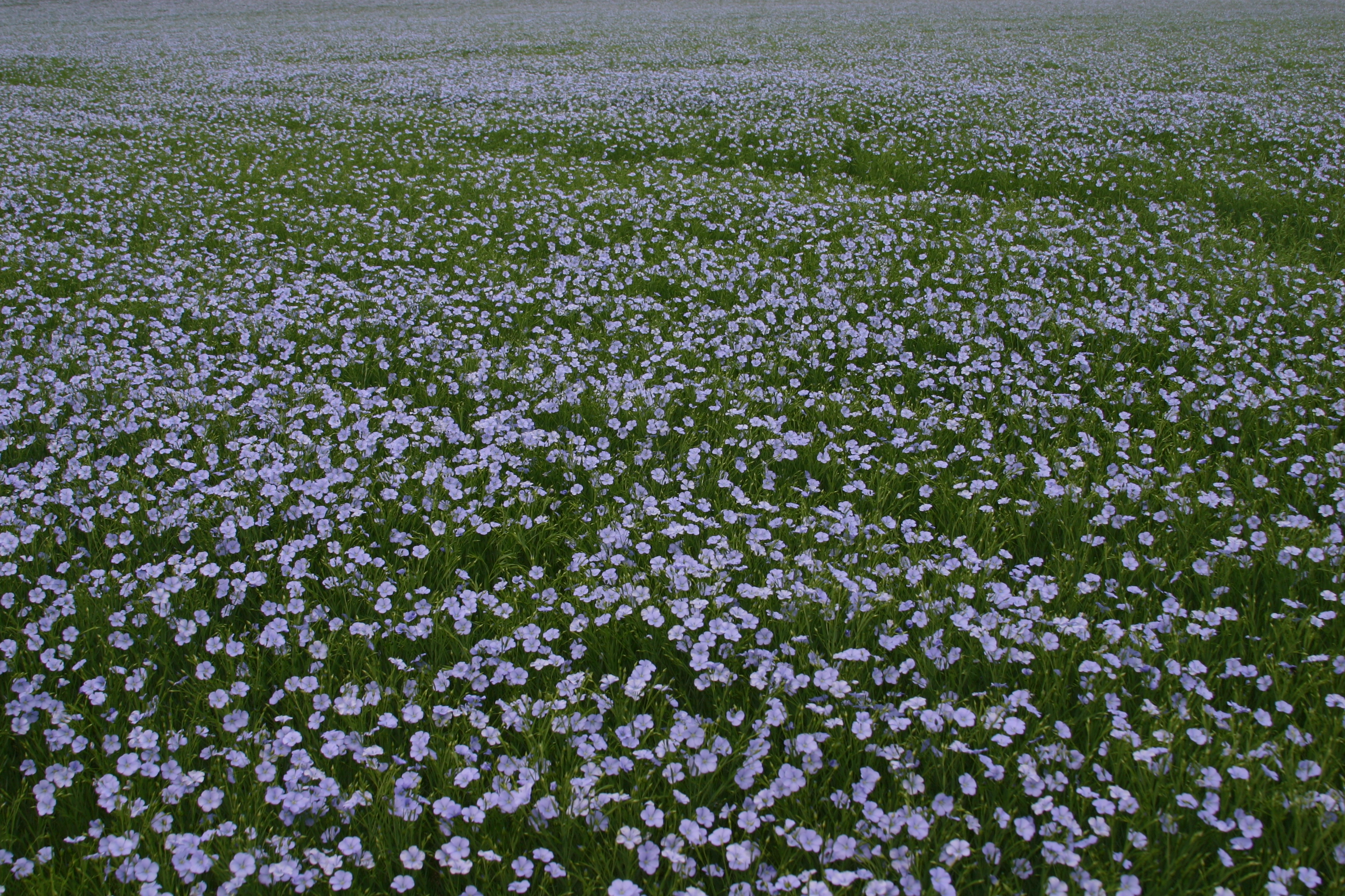
A field of flax in bloom. Source: Wikimedia Commons
There is also a reference to flax in the Schools’ Collection of the National Folklore Collection of Ireland, an initiative from the 1930s which encouraged Irish schoolchildren to collect and document their local folklore and history.
One Malahide entry18 describes how:
There are some fields near Yellow Walls called “The Ponds” and long ago there used to be flax mills there. So there were ponds of water necessary to steep the flax. In those fields there are two large walls which used to prevent the water from going further and so all the water was kept together. Those fields are now called “The Ponds” by everyone.
There was a mill in Yellow Walls but it was used to process cotton rather than flax. There may though have been some flax-related activities on the site that predated the cotton mill.
The other explanation is that vegetable dyes were used by local craftworkers to dye linen, wool and silk, which when placed on the walls to dry, left the same yellow stains.2
The name “Yellow Walls” dates from at least the eighteenth century, appearing on Rocque’s 1756 map of County Dublin. This is before Lord Talbot built his cotton mill at Barrack Bridge. The origins of the name then are not associated with dyeing or bleaching of textiles manufactured in the mill.
The modern day townland of Yellow Walls encompasses what was once two separate areas – Hamonstown (or Hamonswood) to the east of the Gaybrook stream and Balregan to the west of it.3
Hamon is a Norman form of the Old Norse word Hamundr, a personal name that was used amongst the Vikings of Dublin before the Anglo-Norman invasion.4 The name ‘Hamonstown’ reflects Malahide’s links with these early inhabitants of Fingal.
Both Hamonstown and Balregan are referred to in John D’Alton’s History of the County of Dublin.5
Malahide has been a lordship or manor in the Talbot family for centuries, having courts leet or baron, and comprising the towns and lands of Feltrim, Hamonstown, Balvenstowns, &c.
and:
An inquisition was taken in 1547 concerning the tithes of Malahide; which finds that they issue from the lands called “the Courte de Malahyd” and Balregan.
Sometime – probably in the late 17th to early 18th centuries – the name changed, but why?
When looking for the origins of a placename, it is useful to look at places with similar or identical names for clues and pointers.
According to the Placenames Database of Ireland,6 there are three other Yellow Walls townlands in Ireland – two in county Dublin at Palmerstown and Mulhuddart and one near Navan in county Meath.
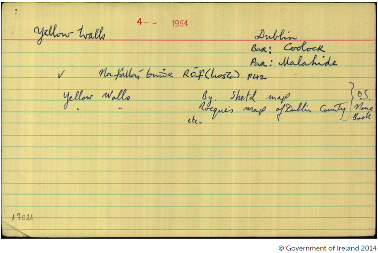
Original record from the Placenames Commission for Yellow Walls, Malahide. Source: www.logainm.ie.
Palmerstown was, at one time, a major centre of textile manufacturing known for flax growing and processing. The Dublin Historical Record reveals that “The southern bank of the river [Liffey] between Chapelizod and Palmerstown was one time the site of flax mills. Across the river were the tenter fields where the flax was spread out to dry.”7
There are remnants of the flax industry still visible in Palmerstown today. There is a former scutch mill dating from 1780 (scutching is the first step in the manufacture of linen where the fibres are stripped from the flax plant). There is also the remains of a flax rettory or flax steep which was used to soak flax bundles in readiness for scutching.8
The actual Yellow Walls townland is about 2 km from Palmerstown village just off the N4 at Quarryvale/Liffey Valley, close to the site of the now “lost village”* of Cursis Stream.9
There doesn’t appear to be any direct connection between flax cultivation and the Mulhuddart townland of Yellow Walls but there is reference to such in the surrounding area, about 9km away, where “there was said to be near Dunsink…great improvement of the barren soil by the planting of flax, trefoil, and clover.” 10
The Yellow Walls townland in County Meath is about 10 km or 6 miles from Navan which, during the 1800s and early 1900s, was renowned for its flax, flour and paper mills.11
The second explanation for ‘Yellow Walls’ lies in the craft of textile dyeing. Traditional dyeing in 17th and 18th century Ireland involved using natural dyestuffs derived mostly from plant sources.
One of the most popular colours for clothing in 17th century Ireland was saffron – a shade of yellow.12 The saffron plant provides the dye of the same name but very large numbers of plants would have been needed to provide even modest quantities making it impractical and too expensive for widespread use. The name ‘saffron’ then was applied to a yellow colour derived from any dye source.
The popularity of yellow dyed linen among the Irish is illustrated in this account:
….linen made part of the dress of the ancient Irish, from the earliest account of their costume, as described in the Islandic Chronicle of AD 1129; and so great was their predilection for this fabric, that sumptuary laws were enacted by Henry VII to restrain its use. By these laws a shirt or smock was ordered to contain no more than seven yards of linen cloth: prior thereto the shirt ordinarily contained thirty yards. It was dyed yellow, but not with saffron…the yellow dye for this purpose was really obtained from the Buidhmor, or great yellow wild woad, a plant that grew abundantly in all the moist soils of the country, and is used for dyeing yellow at this day.12
Yellow wild woad is also known as yellow weed, dyer’s weed or weld. This dye can be used for cotton, wool, silk, and linen.
One of the major suppliers of wild woad in Fingal was William Plunkett of Portmarnock, about 5 km from Yellow Walls. In The History of the County of Dublin5, D’Alton describes wild woad as being “highly prized by the ancient Irish for the yellow dye it afforded; this at Portmarnock has been cultivated for the purpose, and grew to a height of three feet and a half, staining as deep a yellow as that raised at Rouen.”
The scientific name for wild woad is reseda luteola and it is recorded as being a one time common plant in the Malahide area. In “Notes on Malahide”19, published in 1915, WE Vandeleur writes:
Among the common plants of the Malahide flora are a few species widely distributed in the British Isles which are recognized in the Irish-speaking districts of Ireland as having economic or medicinal properties. The Irish names of these species, though not now current in or around Malahide, are still in daily use throughout Gaelic Ireland. Such common species are buide mor, Weld (Reseda Luteola)…The virtues of some of these are still remembered by the Malahide country folk.
Interestingly, The History of the County of Dublin also mentions wild woad in relation to Palmerstown. “By inquisition of 1539, the Priory of St. John the Baptist of Dublin, was found seised [meaning “possessed”] of one castel, thirty messuages, one water-mill, 20a. of arable, meadow, and pasture, and 60a. of woad in Palmerstown near the Liffey.”5
Another source of yellow dye was the furze plant, also known as gorse. References exist detailing its use in dyeing throughout Ireland. As mentioned earlier, modern day Yellow Walls comprises what was once two separate areas called Hamonstown and Balregan. In 1611, there is a reference to “50 acres pasture and firs” at Hamonstown, ‘firs’ meaning furze.13 The yellow colour of the furze flower is also behind other placenames in Ireland, e.g. Knockboy, from Cnoc Buí in county Waterford meaning “Yellow Hill” from the “vivid colour of the blossoming furze.”14
Finally, it is worth mentioning another possible source of the Yellow Walls name. In the Illustrated Guide to Historical Malahide we learn that “one old resident states that when silk was being manufactured here long ago from the cocoons of silkworms, the bleaching of the silken material was the cause of the yellow stains.”1 There may be some truth in this – an 18th century account of silk manufacture relates how raw silk produced by silk worms is yellow and that “yellow silk, partly bleached by soap, being exposed for four or five days to the sun, is rendered of many shades of white”.15 There is also a reference to “the unemployed silk-weavers” of Yellow Walls being given employment in the Talbot cotton mill.
*There is another “lost village” just across the Broadmeadow estuary from Yellow Walls called Ballymadrough. It is also recorded as “Ballamadrough”. Historian Patrick O’Neill attributes the name to the Irish “Bealach M’Eadrog”, the way or pass of Eadar.
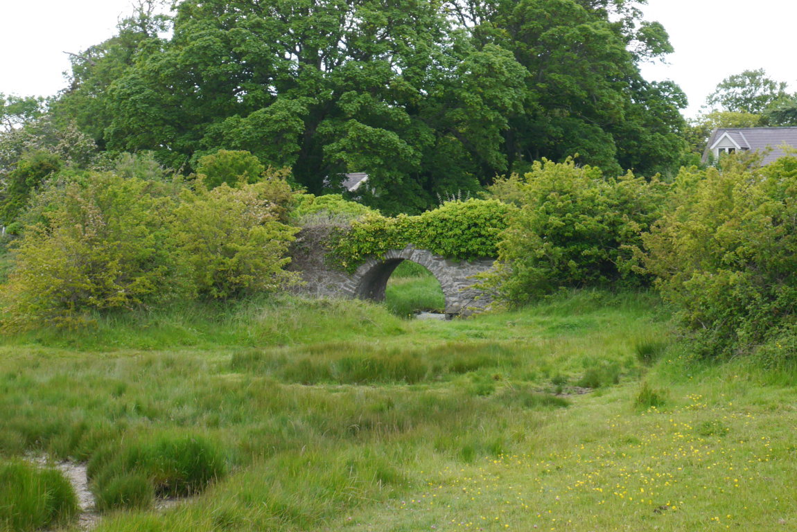
Ballymadrough Bridge – it was built c.1750 to provide access across a tidal stream which powered a nearby mill.17
 “Bealach M’Eadrog” – Newport Harbour, Ballymadrough
Ballymadrough’s location is shown (top middle) on a 1962 hand-drawn map by O’Neill.
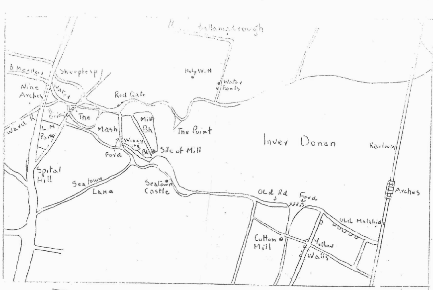
Location of Ballymadrough as shown on O’Neill’s map
The remains of a graveyard are visible at the site and O’Neill speculates that Ballymadrough was a fishing village situated adjacent to a religious site, possibly a nunnery.16
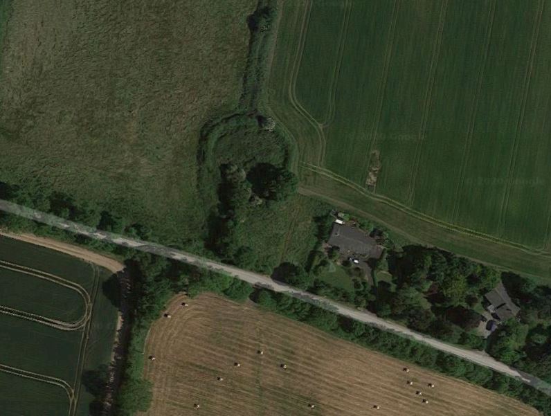
The site of the disused graveyard at Ballymadrough as shown on Google Maps20
Across the estuary at the mouth of the Gaybrook stream, we also have “Bealach Thaighe”, the “passway of Thaighde”, which may be the origin of the Malahide placename.
Sources
1. O’Shea, Tom. Illustrated Guide to Historical Malahide.
2. Malahide Historical Society Newsletter, December 1994.
3. Byrne, Joseph. The Motte, Wheatfield, Portmarnock. Fingal Studies, No. 2, Winter 2011. Fingal County Libraries.
4. Woulfe, Patrick. Irish Names and Surnames. Genealogical Publishing Company, 2010.
5. D’Alton, John. The History of the County of Dublin. Hodges and Smith, 1838.
6. Placenames Database of Ireland [online].
7. McAsey, Carmel. Chapelizod, Co. Dublin. Dublin Historical Record, Volume 17, Nr. 2. Old Dublin Society, March, 1962.
8. National Inventory of Architectural Heritage [online].
9. Palmerstown – Walking Tour, South Dublin County History [online].
10. Ball, Francis Elrington. A history of the county Dublin: the people, parishes and antiquities from the earliest times to the close of the eighteenth century, Volume 6. Alex Thom, 1920.
11. Oliveira, Tiago; Powell, Ronan; McGarry, Christopher; Lombard, Maria. Land Use, Urban Design and Transportation Framework for Navan. SIAS in association with McHugh Consultants, Grontmij and O’Connor Sutton Cronin, 2002.
12. Walsh, Robert, Warburton, John, Whitelaw, James. History of the City of Dublin, from the Earliest Accounts to the Present Time. T. Cadell and W. Davies, 1818.
13. Lucas, AT. Furze: A Survey and History of Its Uses in Ireland. An Cumann Le Béaloideas Éireann/The Folklore of Ireland Society, 1958.
14. Power, Patrick. The Place-Names of Decies. Cork, 1952.
15. Peirce, D (Ed.). Observer and Record of Agriculture, Science and Art, Volume 1. Merrihew and Thompson, 1801.
16. O’Neill, Patrick. An Macalla, No. 10, April 08, 1962.
17. Historic Road Bridges Project – Volume 2. John Cronin and Associates for Fingal County Council.
18. Schools’ Collection of the National Folklore Collection of Ireland. Available online at Dúchas.ie.
19. Vandeleur, WE. Notes on Malahide. W. Tempest, Dundalk. Dundalgen Press, 1915.
20. Google Maps reference: https://goo.gl/maps/LWSxx8VjMpLwKbmN9

