“There are big grass banks and little streams at the end of that road and it is called the Marsh”1
C
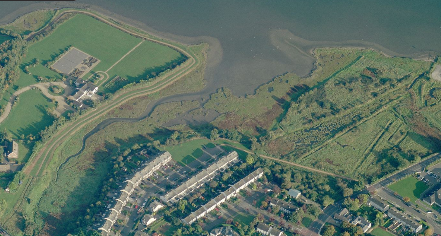
ave’s Marsh is a 12 acre wetland on the southern shore of the Broadmeadow Estuary. One of the most ancient areas of Yellow Walls, its history reaches back for millennia and has seen ancient tribes, Norse warriors, a tide mill and a salt works. The ford at the mouth of the Gaybrook stream which flows through the marsh, may even have given Malahide its name.
Cave’s Marsh is named after a local farming family Cave, who once owned part of the site. In 1962, land was acquired from the Caves for the building of a clubhouse and dinghy pen for Malahide Yacht Club.
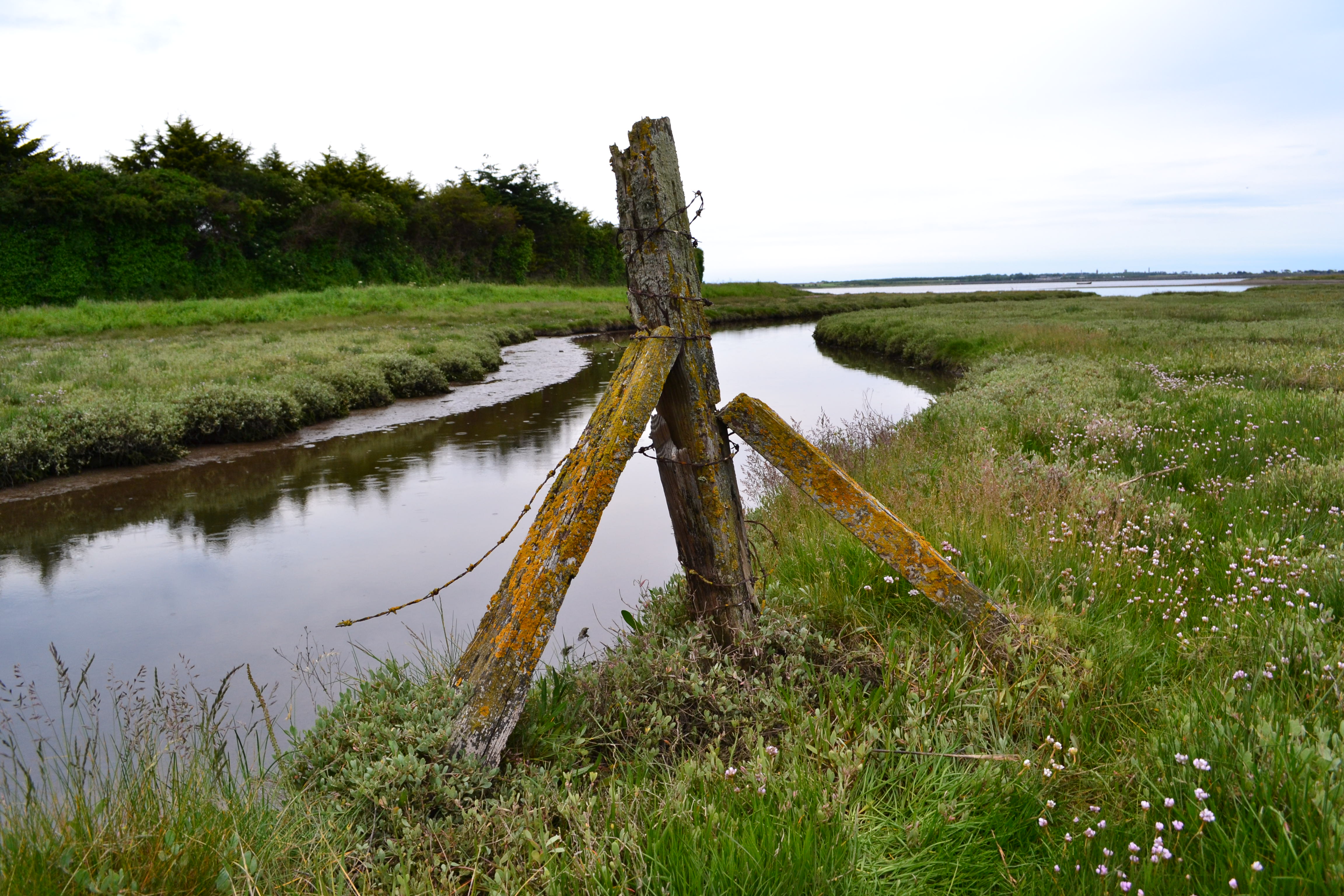
The Gaybrook stream flows under Barrack Bridge and drains into Cave’s Marsh before emptying into the estuary. An environmental impact study2 commissioned in 2007 by Fingal County Council describes Cave’s Marsh as having “a mosaic of habitat types” and lists these as including “salt marsh, areas of rank grassland, scrub, pebble foreshore, brackish pools and freshwater marsh.”

Southern End Of Cave’s Marsh
Cave’s Marsh is an SPA or Special Protection Area. SPAs are designated areas within EU states that have important bird populations. The marsh has a rich and diverse bird population with a total of 91 species being recorded in the aforementioned County Council study. It is an important roosting site for migratory and wintering birds and it also has a rare plant community.
At the northern end of the marsh, close to Malahide Yacht Club, is the site of a disused clay pit. The pit is marked on the OSI historical map below and the remains of it are visible today.
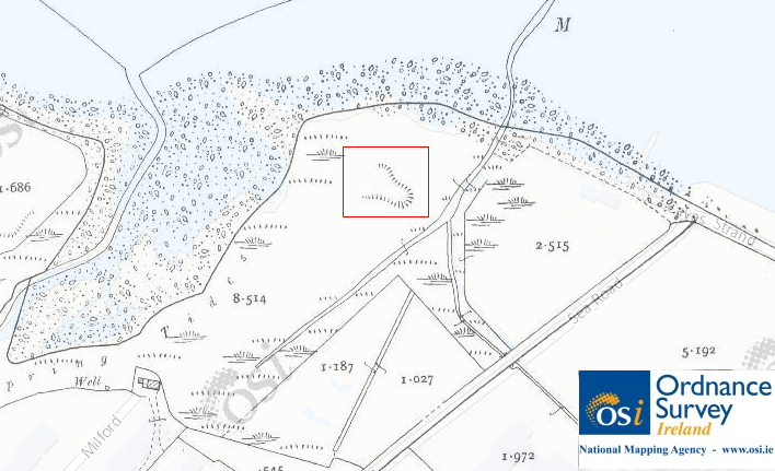
Clay pit marked on OSI 25″ inch map ( late 19th/early 20th century). © Ordnance Survey Ireland/Government of Ireland.3
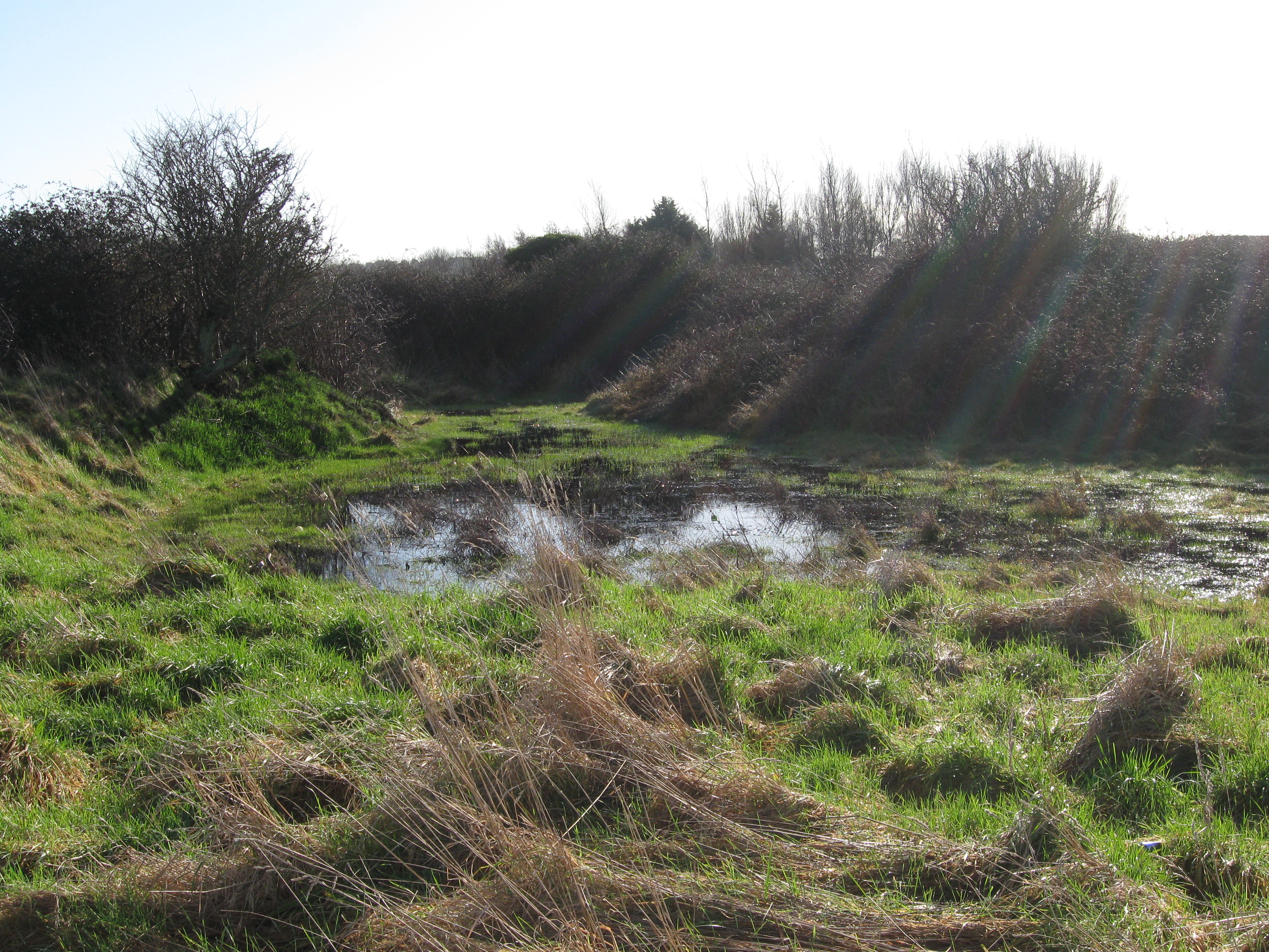
The site of the pit today
Cave’s Marsh is the only section of the southern shore of the Broadmeadow Estuary that isn’t linked into the existing pathway routes between Malahide and Swords. In the past, Fingal County Council proposed to build a walkway across the marsh consisting of a 120 metre long boardwalk raised 1-1.2 metres above ground level. The study commissioned by the Council proposed placing the boardwalk at the southern end of Cave’s Marsh, mainly because this location would be the least disruptive to the birdlife in the area.
 |
 |
 |
The council proposal also included providing a new pathway along the eastern perimeter of the marsh. Combined with selective planting and screening the intention was to channel human traffic through the marsh along specific controlled routes well away from sensitive wildlife areas.
 |
 |
 |
The Fingal County Council development plan for 2017-20234 indicates a proposed cycle/pedestrian route across Cave’s Marsh.
Sources
1. Schools’ Collection of the National Folklore Collection of Ireland. Available online at Dúchas.ie.
2. Fingal County Council, Cave’s Marsh Study 2007, Spatial distribution of wintering wader and wildfowl and the effects of human impact on the site. Fingal County Council Report.
3. Ordnance Survey Of Ireland 25″ Map: [online]. Reproduced under licence from Ordnance Survey of Ireland; Licence No. NE 0000414.
4. Fingal Development Plan 2017-2023. Fingal County Council. Available online.

