“Richard Talbot of Malahide proposed to make a navigable canal from Malahide through Swords, to the river of Fieldstown, at his own proper charges…“1

The same Richard Talbot that built the cotton mill also proposed in 1788 to construct at his own expense a navigable canal from the harbour in Malahide through Swords to the river at Fieldstown in County Meath, ultimately to merge with the Boyne Navigation Canal. The river at Fieldstown is the Broadmeadow river which flows into the upper estuary at Malahide, giving it its modern-day name.1
Talbot intended to transport more cheaply inland, the goods that were landed at Malahide harbour and normally carried by road. These goods included coal, slates, culm (fine pieces of anthracite coal) and timber.
Talbot was granted permission to purchase the land along the route of the canal and to carry out the required engineering works – for example, building weirs and opening water supply channels from rivers. Unfortunately, Talbot died before the canal could be realised.
Even after Talbot’s death, the project was still viewed as being feasible. At the beginning of the 19th century, a “statistical survey” of county Dublin was performed with the objective of making recommendations on how improvements might be made in areas such as agriculture, manufacturing and transport links. Joseph Archer, the author of the report, concluded2 that:
I conceive a canal from Mallahide [sic], carried under Lissenhall bridge*, and into the interior of the country could be easily effected; if the transport of coals only could be accomplished, it would be highly advantageous; but another very material object is connected with it, the improvement of upwards of 1,500 acres of ground, chiefly the estate of Mr. Talbot; this could be executed with great ease, and at a comparatively small expense…
Lissenhall Bridge (Source: Patrick Healy Collection, published by South Dublin County Council)

In an 1851 map3 (shown below) there is a canal running from the mill race along Old Yellow Walls road, marked as “Canal and Half Road” (a “half road” is essentially a pathway). This is some 60 years after the plan was first mooted. Could the scheme have been initiated but then abandoned upon Talbot’s death, with this section of unused canal remaining in place for decades until it was eventually filled in?
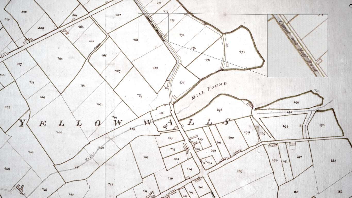
1851 Map Showing “Canal and Half Road”
It seems possible – an account from 1891 of an “Excursion to North Dublin”4, recounts how Talbot “got an Act passed to enable him to make a canal between Malahide and Swords and the river of Fieldstown, which canal can still be traced. But nothing permanent came of it.” In the same map, to the the west of the canal where Seabury Green is now situated, there is a track or pathway marked ‘Passage’ that leads on to Estuary Road.
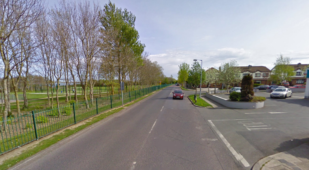
Old Yellow Walls Road where the “Canal and Half Road” is marked in the 1851 Map
*An interesting archaeological study5 was done in 2009 at Lissenhall bridge (dated to c. 1760 and possibly incorporating the fabric of a pre-1600 bridge)6 and at Balheary bridge, which crosses the Ward river. The report is available online.
Sources
1. D’Alton, John. The History of the County of Dublin. Hodges and Smith, 1838.
2. Archer, Joseph. Statistical survey of the county Dublin:with observations on the means of improvement; drawn up for the consideration, and by order of the Dublin society. Graisberry and Campbell, 1801.
3. Survey of the Town and Lands of Malahide. Clarges Greene & Son, 1851.
4. Stokes, DD. Excursion to North Dublin, Wednesday, 1st July, 1891. The Journal of the Royal Society of Antiquaries of Ireland, Fifth Series, Vol. 1, No. 7, 3rd Quarter, 1891.
5. Underwater Archaeological Assessment Metro North Project, Broadmeadow River, Lissenhall Bridge, Balheary Demesne/Lissenhall Great,
Swords, Co. Dublin 08D093, 08R311 & Ward River, Balheary Bridge, Balheary Demesne, Swords, Co. Dublin 08D092, 08R312. The Archaeological Diving Company Ltd. for the Railway Procurement Agency, 2009.
6. National Inventory of Architectural Heritage: online.

