“Richard Wogan Talbot, Esq. of Malahide has received letters of service to raise a regiment of infantry in this kingdom.”3

B
arrack Bridge is situated on Old Yellow Walls road and crosses the Gaybrook stream just before the stream enters Cave’s Marsh. It is a single arch rubble stone bridge and is named after a barracks that was built nearby at Barrack Hill in the late 1700s.
The bridge was built c.1860 and is described in one architectural study2 as featuring “rubble limestone walls with cut stone voussoirs and limestone copping to parapet walls…the fine limestone masonry is clearly the work of skilled craftsmen.” A voussoir is a wedge shaped brick or stone used in constructing an arch – visible in the image shown below.
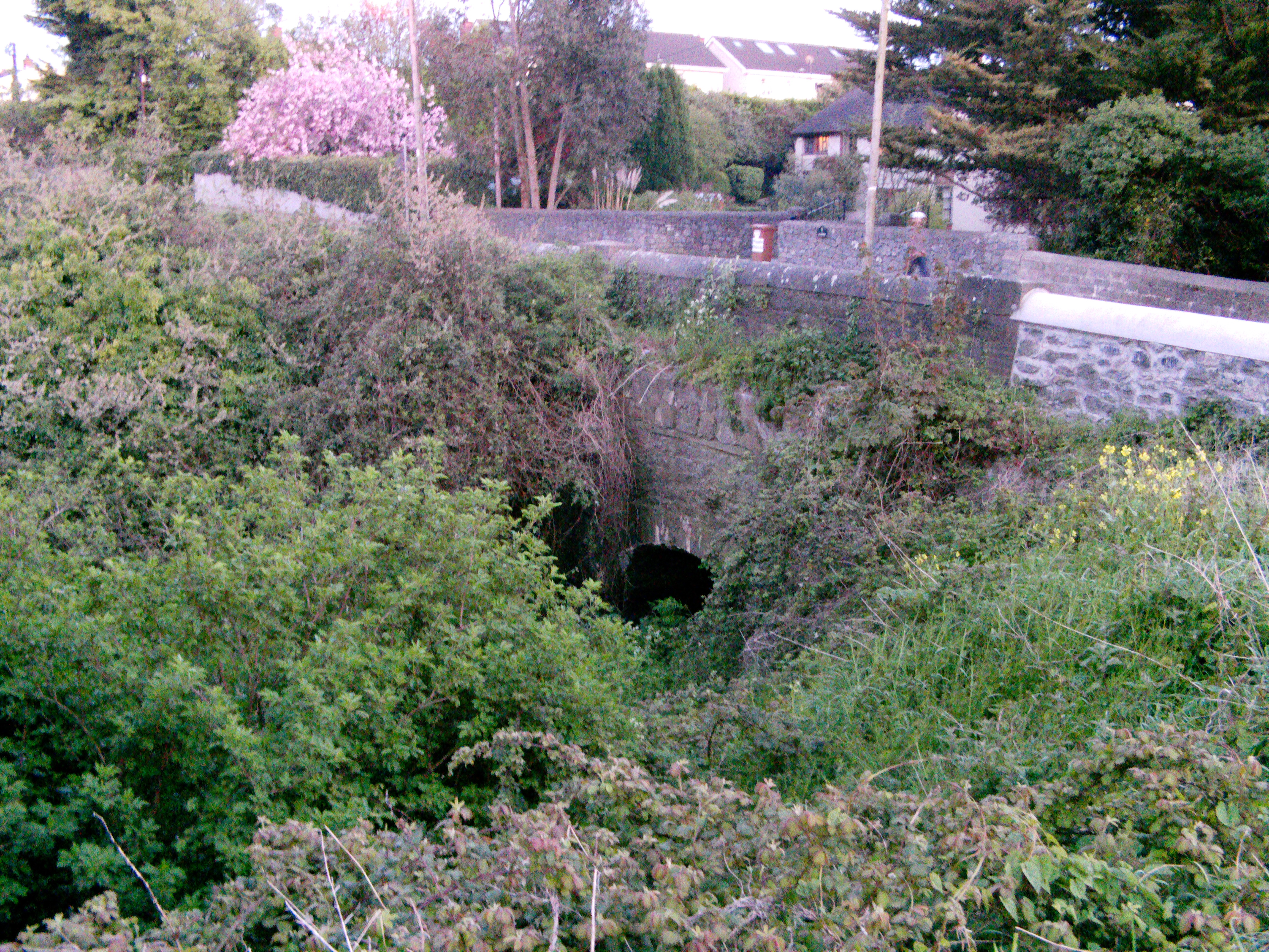
Barrack Bridge – Built c.1860
The barracks were built by Richard Talbot to garrison a regiment of ‘fencibles’, which he formed or “raised” in 1794.3 Fencibles were a type of home guard used to protect the country from both foreign invasion and internal rebellion. Each fencibles regiment was raised locally and consisted of 8 companies. The government provided uniforms, arms and pay.4
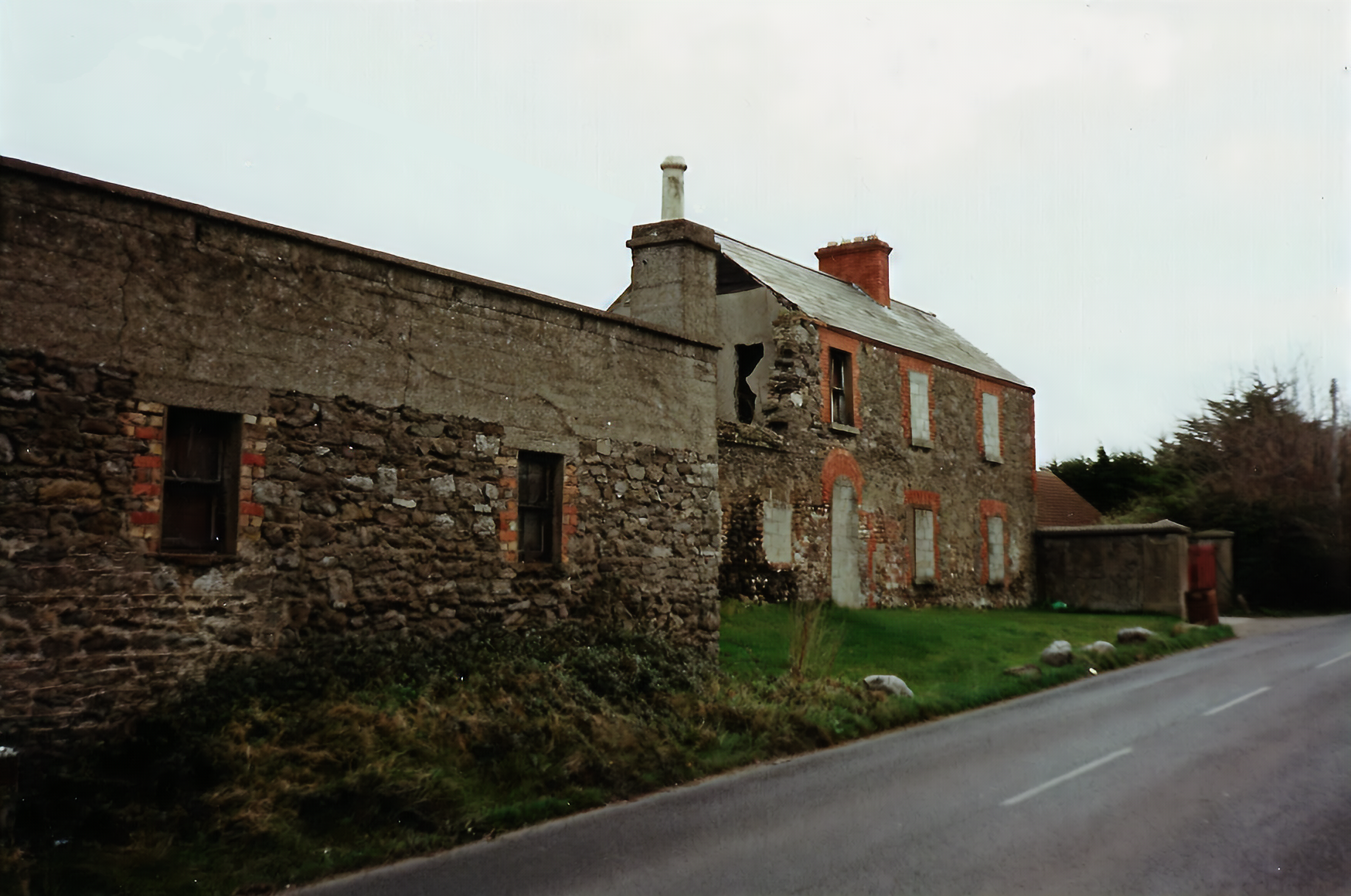
Barracks that once stood on Old Yellow Walls Road
The uniforms worn by the Talbot fencibles are described in one account as “scarlet faced black, white breeches and waistcoats.”1
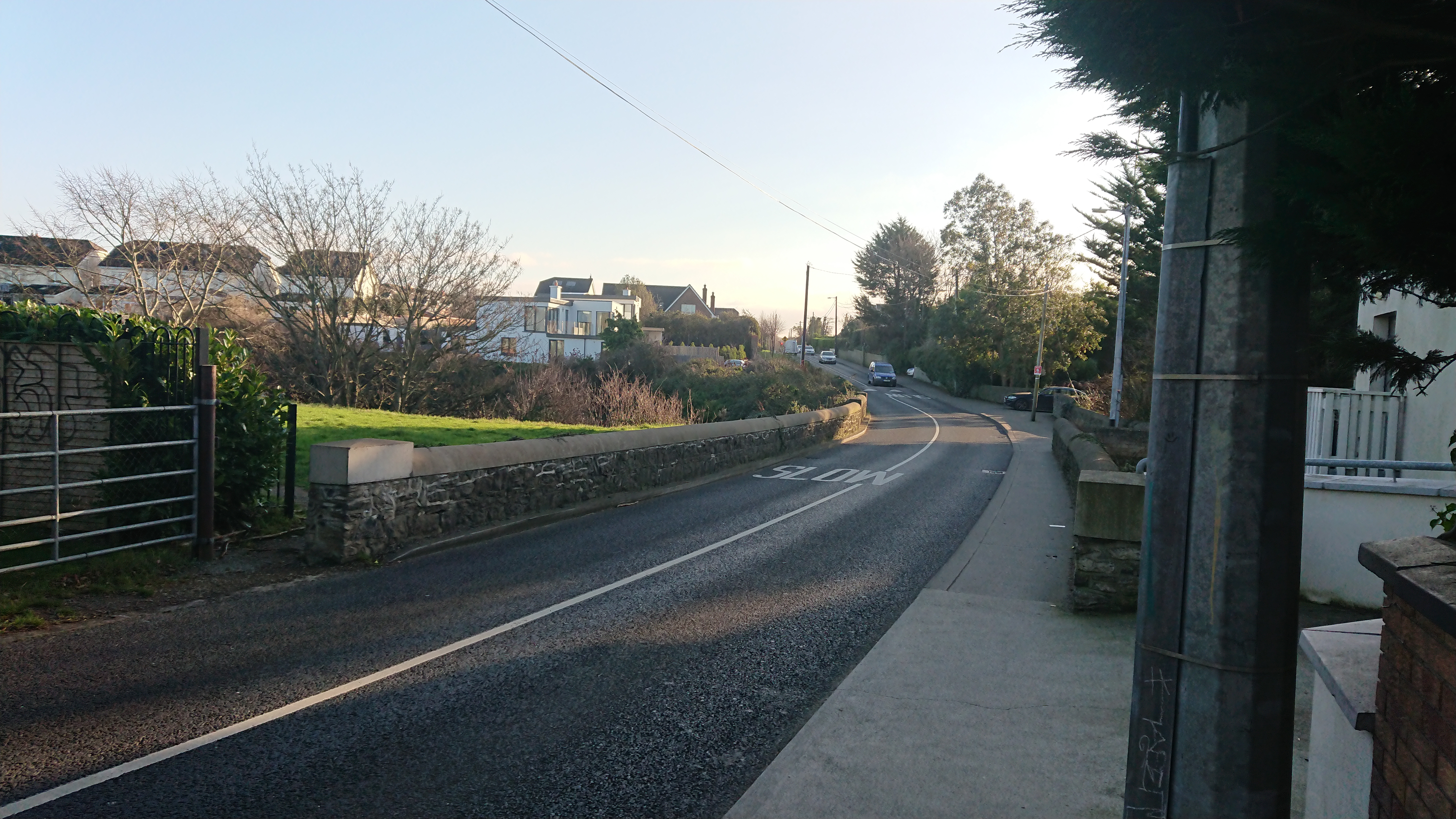 Barrack Bridge from Old Yellow Walls Road
The map below from the mid-1800s shows the barracks and a number of other buildings surrounding it at “Barrack Hill”.5 Over the years, other regiments besides Talbot’s fencibles used the barracks, including the King’s County (Offaly) regiment, the Brigade of Guards and, during the 1798 rebellion8, the Durham Light Infantry (also known as the 68th). A newspaper report9 from 1797 reports the death “in Malahide Barrack, Mr. David Aird, Quarter-Master in the 68th regiment”). The site is also where Henry Downes, a deserter from the King’s County regiment, was hanged.
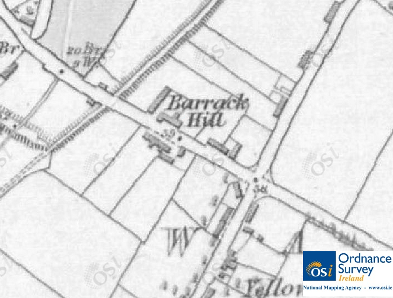
The Barracks at “Barrack Hill”, mid-1800s. © Ordnance Survey Ireland/Government of Ireland.5
The barracks were in use until at least the late 1800s – a newspaper report from 1882 states that:
an officer and 25 non-commissioned officers and men of the Brigade of Guards, was yesterday despatched by rail from Amiens street to Yellow Walls, near Malahide, to afford any required assistance to the civil power.6
The “assistance to the civil power” is probably a reference to the “Land Wars”, which were ongoing at the time with unrest and violence throughout Ireland between supporters of the Land League and the authorities. Andrew Kettle, who lived nearby at Millview House, was one of the founders of the Land League, which aimed to reform the Irish landholding system. A newspaper report7 from 1885 describes an eviction in Yellow Walls: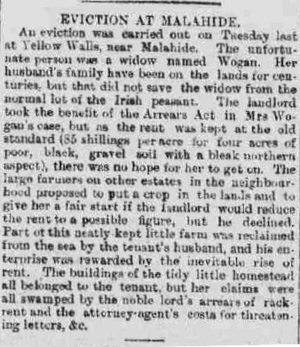
The barracks eventually fell into disuse and the ruins of one of the buildings facing onto Old Yellow Walls road stood until the early 1990s, when it was demolished to make way for the Milford estate. The building was located at the entrance road to the estate.

Entrance to Milford where the Barracks once stood
On the other side of the road, about 150 metres down, is where Malahide National School was once situated. Previously, for a time, the school was also housed in the disused Talbot cotton mill.
Sources
1. Morley, Vincent. Irish opinion and the American Revolution, 1760-1783. Cambridge University Press, 2002.
2. Fingal Coastal Architectural Heritage Project: online. John Cronin and Associates for Fingal County Council, 2010.
3. Saunders Newsletter, 04 July, 1794.
4. Gilbert, Sir John Thomas. A history of the city of Dublin, Volume 3. J. McGlashan, 1859.
5. Ordnance Survey Of Ireland 6″ Map: online. Reproduced under licence from Ordnance Survey of Ireland; Licence No. NE 0000414.
6. Irish Times, February 24, 1882.
7. Freeman’s Journal, April 24, 1885.
8. Vane, WL. Durham Light Infantry: The United Red and White Rose. Andrews UK Limited, 2012.
9. Dublin Evening Post, 03 August, 1797.

