“Some time ago I noticed one of those grotesque female figures known as Sheela-na-Gigs carved on a pillar which acted as a gate-post at Drynam House near Swords, Co. Dublin. It was in danger of destruction by farm-carts passing by…”1
The Gaybrook stream figures prominently in the history of Yellow Walls, most notably as the power source that drove the cotton mill at Barrack Bridge back in the late 18th century. Also, it flows into the Broadmeadow estuary at Cave’s Marsh, one of the most historic sites in Yellow Walls.
The Gaybrook ‘rises’ or has it source at Fosterstown North, a townland to the south of Swords, where the Boroimhe estate is situated, around 4 km from the estuary.2
Gaybrook stream – From Fosterstown to the Broadmeadow Estuary
From there, it flows in an easterly direction through the townland of Crowscastle, much of which is occupied by the Airside retail and business park. It receives three small inflows here and passes the site of the ancient St. Werburgh’s Well.
The well, shown on maps dating back to the late 1800s, is named after an Anglo Saxon princess who lived in the seventh century AD and became a Benedictine nun at an early age. She is the patron saint of Chester, a city in the northwest of England. The most well-known tale associated with the saint concerns her reputedly restoring five geese to life (in medieval iconography, St Werburgh’s main emblem is a goose.3 ) The well site became overgrown over time but was re-dug by enthusiasts in 2011 in a slightly different position.
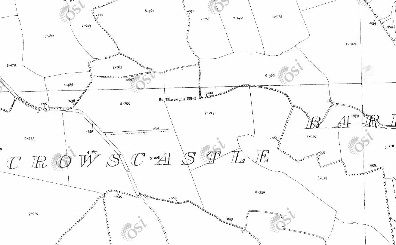
19th Century Ordnance Survey Map showing St. Werburgh’s Well and the townlands of Crowscastle and Barrysparks. © Ordnance Survey Ireland/Government of Ireland.4

St. Werburgh’s Well, Crowcastle.
The remaining undeveloped areas of Crowscastle and the adjoining townland of Barrysparks are earmarked for further development as part of Fingal County Council’s Local Area Plan which includes apartments, houses, a hotel and several new link roads.5 This plan includes preservation of the well and another archaeological site located nearby called a ring ditch as shown below.
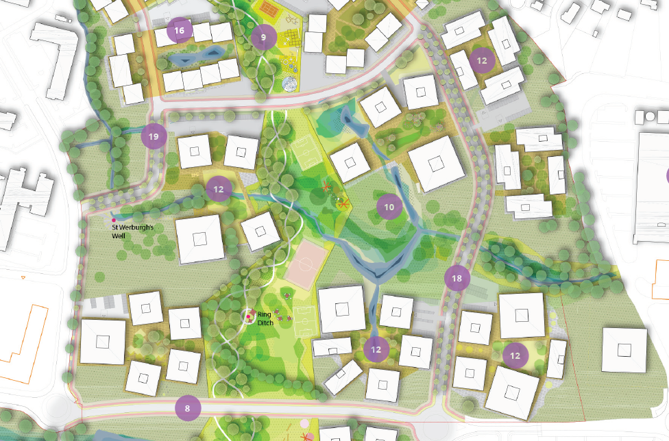
Section of Barrysparks and Crowscastle Masterplan showing St.Werburgh’s Well and the ring ditch. The plan includes offices (12), a connection (18) to the proposed Airside-Feltrim Link Road (8), and apartments (16). © Fingal County Council5
A ring ditch is “a trench of circular or penannular (incomplete circle) plan, cut into bedrock. They are usually identified through aerial photography either as soil marks or cropmarks. When excavated, ring ditches are usually found to be the ploughed‐out remains of a round barrow (a large mound built over a gravesite), where the barrow mound has completely disappeared, leaving only the infilled former quarry ditch.”6 Ring ditches dating from the Neolithic and Bronze Age ring ditches have been discovered. The ring ditch at Crow Castle is about 13m in diameter.
Leaving Barrysparks, the Gaybrook moves underground, passing under the M1 motorway and into the townland of Drynam (a corruption of Drinan from the Irish for blackthorn). A stone bridge once spanned the stream until it was demolished for road straightening works. The bridge is shown on an ordnance survey map from the 1930s.4
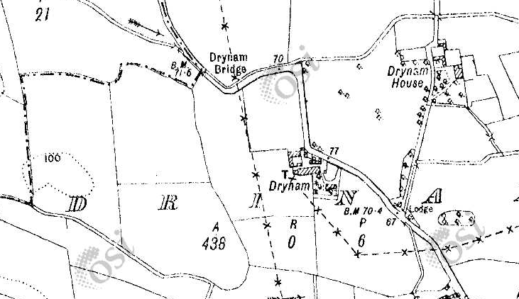
Drynam Bridge shown on map from the 1930s. © Ordnance Survey Ireland/Government of Ireland.4
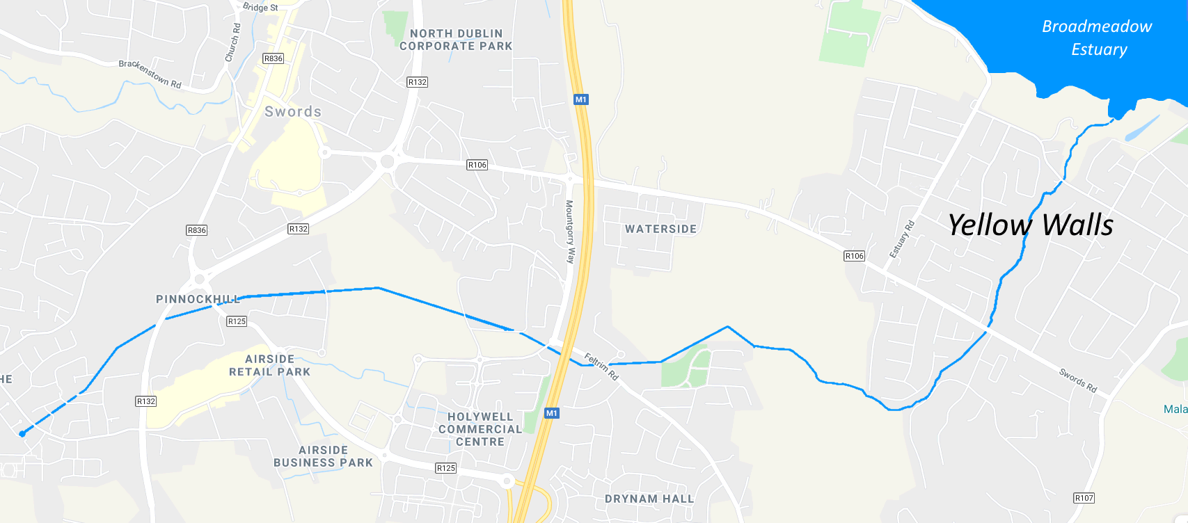
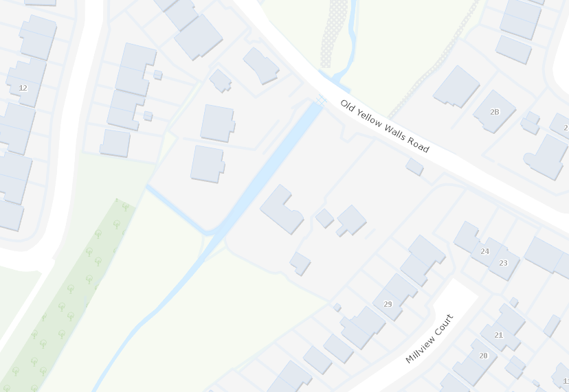
For comparison, the modern day map below shows where the bridge was located.
Modern day map showing where Drynam Bridge was located.
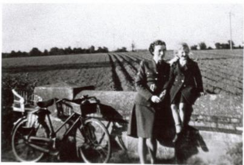
Old Drynam Bridge in 1948. Source: http://www.swordsheritage.com/
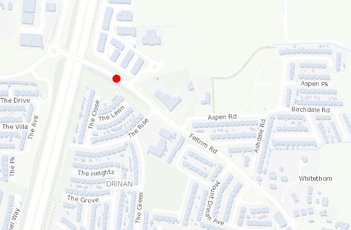
The stream then flows to the rear of Scoil an Duinnínigh and down past the Aspen housing estate. This estate is where Drynam House once stood on around 470 acres.
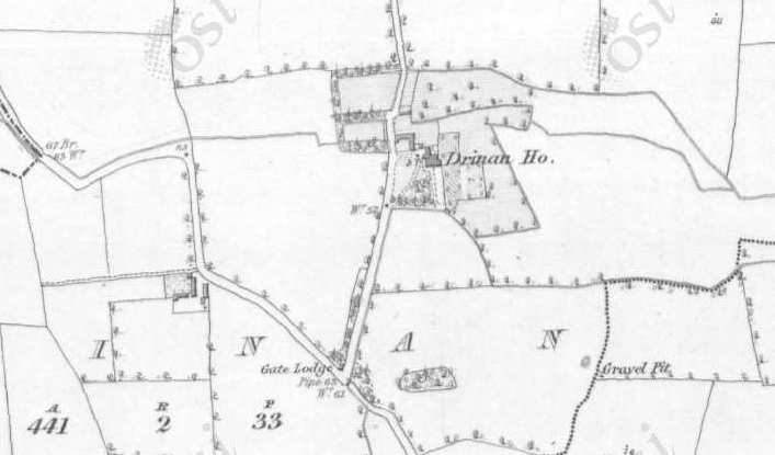
Drynam House (also known as Drinan House) shown on 19th century Ordnance Survey map. © Ordnance Survey Ireland/Government of Ireland.4
The house was built by the Russell-Cruise family around 1627 in the Jacobean architectural style.7 It remained in the family until it was sold in the 1920s to a family called Wilson. The Russell-Cruises also built Seatown castle on the shores of the Broadmeadow estuary.

Drynam House
The Kettles of Millview House in Yellow Walls shared a connection with the Russell Cruises and Drynam. Andrew Kettle, father of the poet, politician and lawyer Tom Kettle, and a prominent figure in his own right in the Land League, was born in Drynam in 1833. He farmed the Russell-Cruise demesne lands during the years when Robert Russell-Cruise was living in France.8 Later he moved to Kilmore, Artane, where he had acquired three holdings. After some years he moved to Millview, Malahide where his son Tom was born.
A curious tale relating to Drynam House concerns a ‘Sheela-na-gig’ (an ancient figurative carving of a naked woman. They were erected on many churches of the medieval period, usually in a prominent position such as over the main entrance door or a window.9 They are said, amongst other things, to represent fertility or a pagan goddess).
The figure was carved into a stone pillar which served as a gate post at the top of the driveway leading up to the house. This is where the gate lodge once stood on the present day Feltrim Road (as shown on the map below). It was removed from this location on the initiative of a Father John Dunlea who related that:
Some time ago I noticed one of these grotesque female figures known as Sheela-na-Gigs carved on a pillar which acted as a gate-post at Drynam House near Swords, Co. Dublin. It was in danger of destruction by farm-carts passing by, so I brought it to the notice of Mr. H. G. Leask, Inspector of National Monuments. He communicated with the National Museum and, on Mr. Wilson of Drynam House graciously giving permission, the stone was carefully removed and is preserved in the museum.1
Before moving on from Drynam, a short flow feeds into the stream from an old well near the site of the house.
From Drynam, the stream veers in a south easterly direction away from a former pathway that led from Drynam to the Malahide-Swords road. Known as Glebe road, it passed through the land of a family called Dickies.10
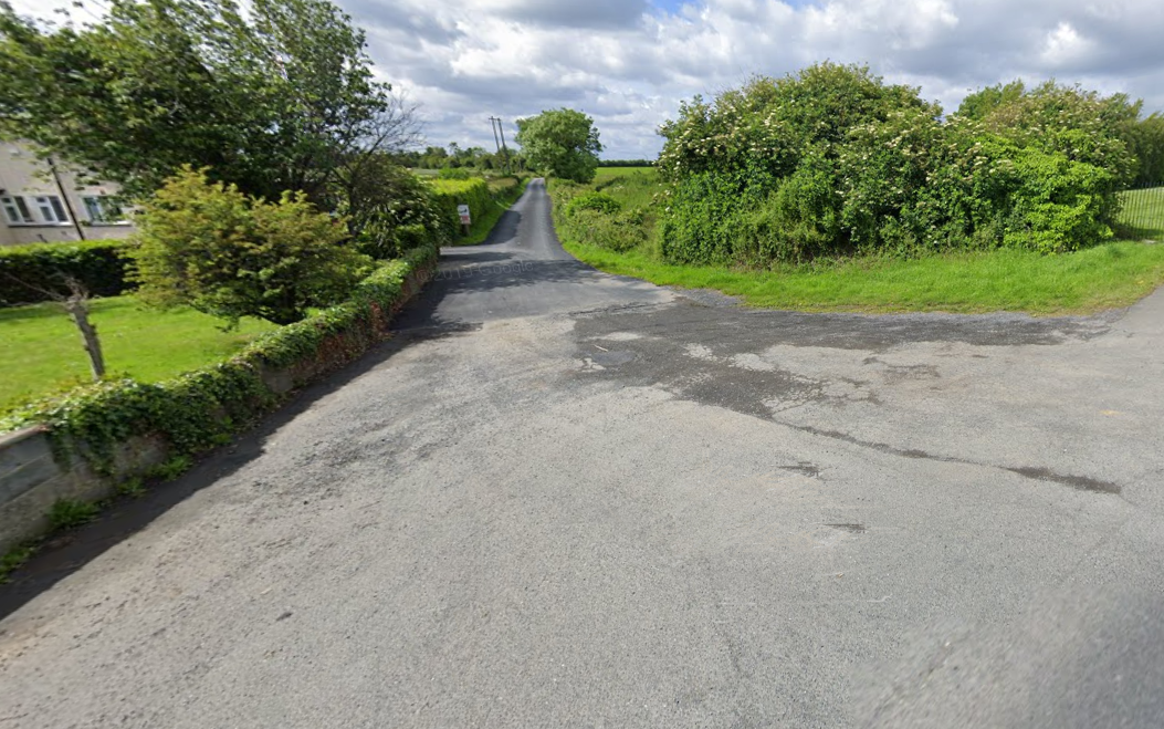
Glebe Road that led from Drynam House viewed from the Malahide-Swords Road (Source: Google Maps)
At the western end of Gainsborough Park another tributary flowing from Crowscastle joins the stream. This area was once part of the lands of Gaybrook House.
The stream then veers northwards to flow under the Malahide-Swords road via a bridge once known as Sutton bridge. A family named Sutton lived in the nearby gate lodge of Gaybrook House in the 1920s and 30s.
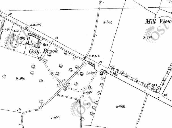
19th century Ordnance Survey map showing Sutton Bridge, Gaybrook House and the gate lodge
The stream is now in a marshy area known variously as The Bottoms or The Ponds. Here it receives another tributary flowing underground from Mountgorry.2
Tributary from Mountgorry feeding into Gaybrook stream
Around 250 years ago, the stream was the source of power for a cotton mill established in 1783 by Colonel Richard Talbot, Lord of Malahide. In order to provide the required volume of water to drive the mill wheel, some of the stream’s flow was diverted into a man-made reservoir called a mill pond (hence the name ‘The Ponds’.) The mill pond occupied low ground between the present day housing estates of Millview on one side of the stream and Killeen and Seabury on the other.
From The Ponds, the stream flows under Old Yellow Walls road at Barrack Bridge, named for the barracks that once stood nearby, and into Cave’s Marsh. To the east another small stream flows into the marsh from its source in the Sonesta estate.
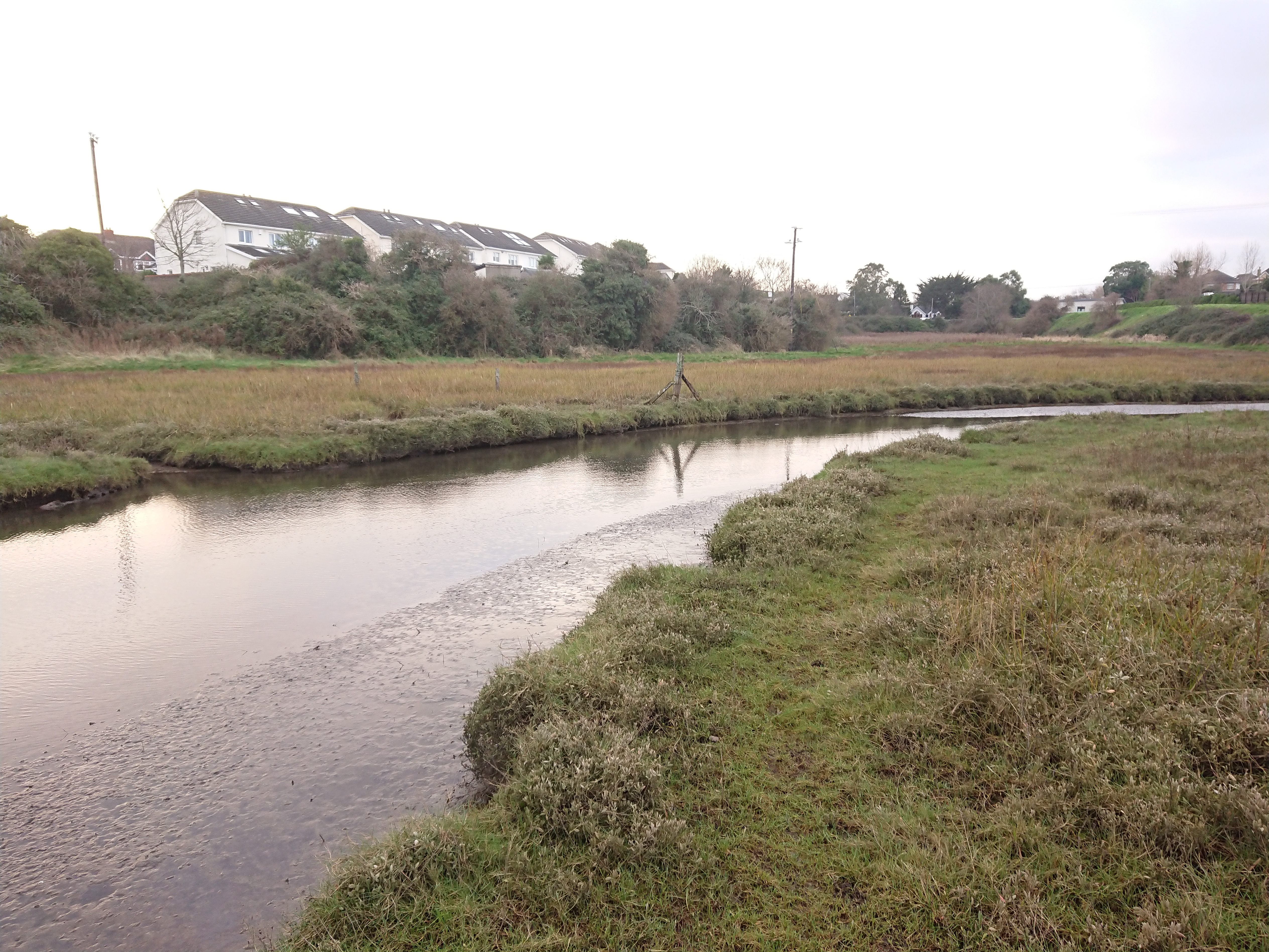
Gaybrook stream in Cave’s Marsh
Finally, the Gaybrook enters the Broadmeadow estuary at what was once the site of a ford or crossing. It has been speculated that the name of the ford “Bealach Thaighe” (passway of Thaighde) is the source of the placename “Malahide”.10
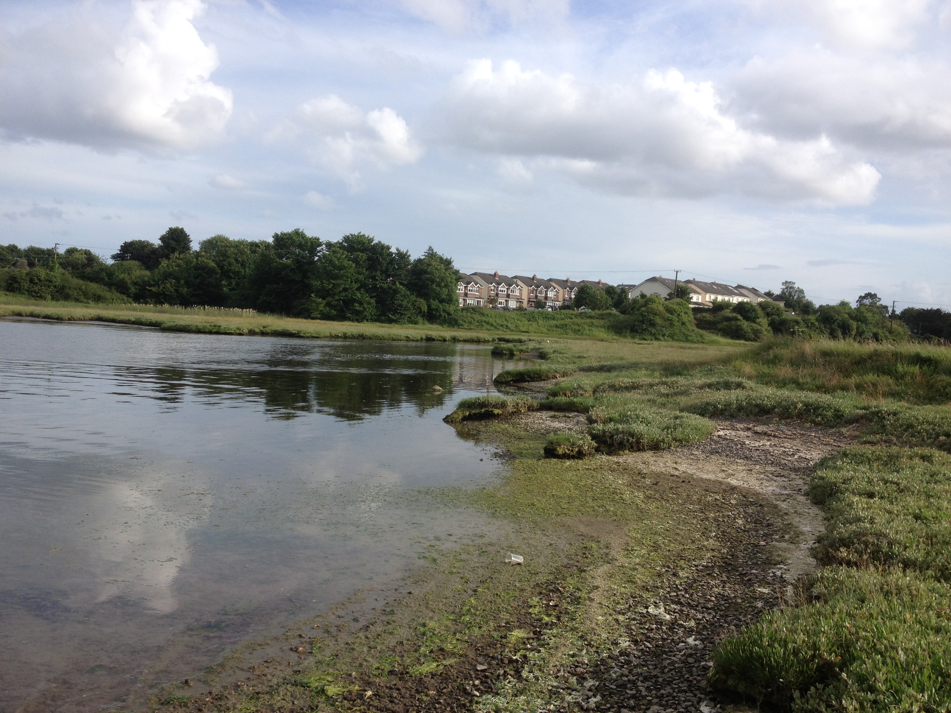
Site of the ford at the mouth of Gaybrook stream – “Bealach Thaighe”
Sources
1. The Journal of the Royal Society of Antiquaries of Ireland. Vol 75, March, 1945.
2. Doyle, Joseph W. Ten Dozen Waters: The Rivers and Streams of County Dublin. Rath Eanna Research, 2011.
3. Jones, John Idris. Secret Chester. Amberley Publishing Limited, 2017.
4. Ordnance Survey Of Ireland, Public Map Viewer [online].
5. Fingal County Council. Swords Masterplans Part B: Barrysparks & Crowscastle. May, 2019.
6. Darvill, Timothy. The Concise Oxford Dictionary of Archaeology. Oxford University Press, 2008.
7. Lewis, Samuel. A Topographical Dictionary of Ireland. S. Lewis, 1837.
8. Kettle, Andrew J. The Material for Victory: Being the Memoirs of Andrew J. Kettle. Fallon, 1958.
9. Roberts, Jack and McMahon, Joanne. The Sheela-na-gigs of Ireland & Britain: The Divine Hag of the Christian Celts : an Illustrated Guide. Mercier Press, 2001.
10. O’Neill, Patrick. An Macalla. No. 10, April 08, 1962.

