“[Old Street] was the original village street that twined to Yellow Walls, a district now, on the estuary beyond the railway embankment”1

Crossroads, Yellow Walls
Rocque’s map2 of 1760 shows Yellow Walls as a hamlet lying between “Pea Fields” and Cave’s Marsh [the name “Pea Fields*” is no longer in use locally]. Some 50 years later, thanks to the prosperity brought by the local cotton mill, Yellow Walls had grown to be bigger than neighbouring Malahide village.
Even after the subsequent failure of the cotton industry the population of the townland of Yellow Walls remained higher than that of Malahide for several decades. The 1851 census recorded a population of 387 for Yellow Walls compared with 323 for Malahide, while the number of houses in each townland was 81 and 60, respectively.3

Extract from Rocque’s 1760 Map of County Dublin showing Yellow Walls and Pea Fields
The “Mallahide Mill(s)” indicated on Rocque’s map doesn’t refer to the cotton mill – it wasn’t built until some 20 years later. It refers instead to a tide mill which existed from medieval times and was located somewhere in the vicinity of Cave’s Marsh.4
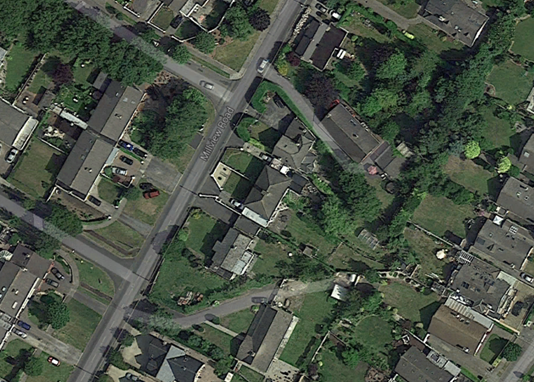
At the centre of Yellow Walls is a crossroads. The four roads that meet there are Yellow Walls Road, Old Yellow Walls Road, Millview Road and Sea Road. Sea Road was the road that led to Yellow Walls from what was the original main street of Malahide village, now called Old Street.1
The 6” historical maps of Yellow Walls completed between 1829 and 1842 show the main concentration of buildings stretching along either side of Millview Road.
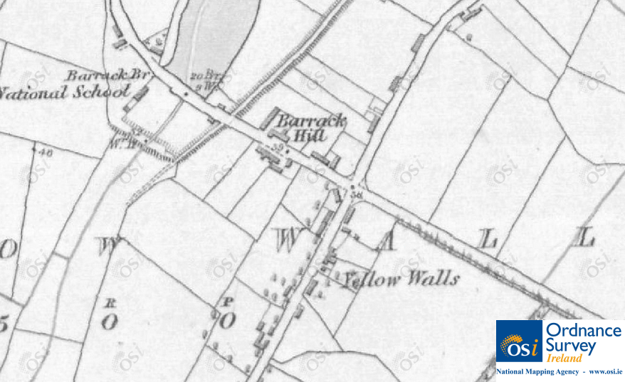
5″ width=”500″ height=”306″> 6 inch map of Yellow Walls showing buildings along Millview Road. © Ordnance Survey Ireland/Government of Ireland.5
The 25” maps, completed between 1887 and 1913, show the ‘centre’ of Yellow Walls further down Millview Road.
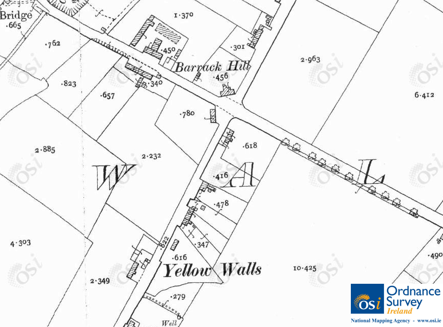
25 inch map of Yellow Walls. © Ordnance Survey Ireland/Government of Ireland.6
The boundaries that form the two sides of the triangular shape in the 25” map are visible today on the grounds of two private properties.
The Yellow Walls depicted on the OSI historical maps is an example of a settlement known as a “crossroads cluster”, i.e. a cluster of houses without services such as schools or churches.8
A number of Yellow Walls’ buildings have endured over the years including a well-maintained thatched cottage on Sea Road. Known as Pegram’s Cottage, it was built in 1850 for workers on the nearby Talbot estate.
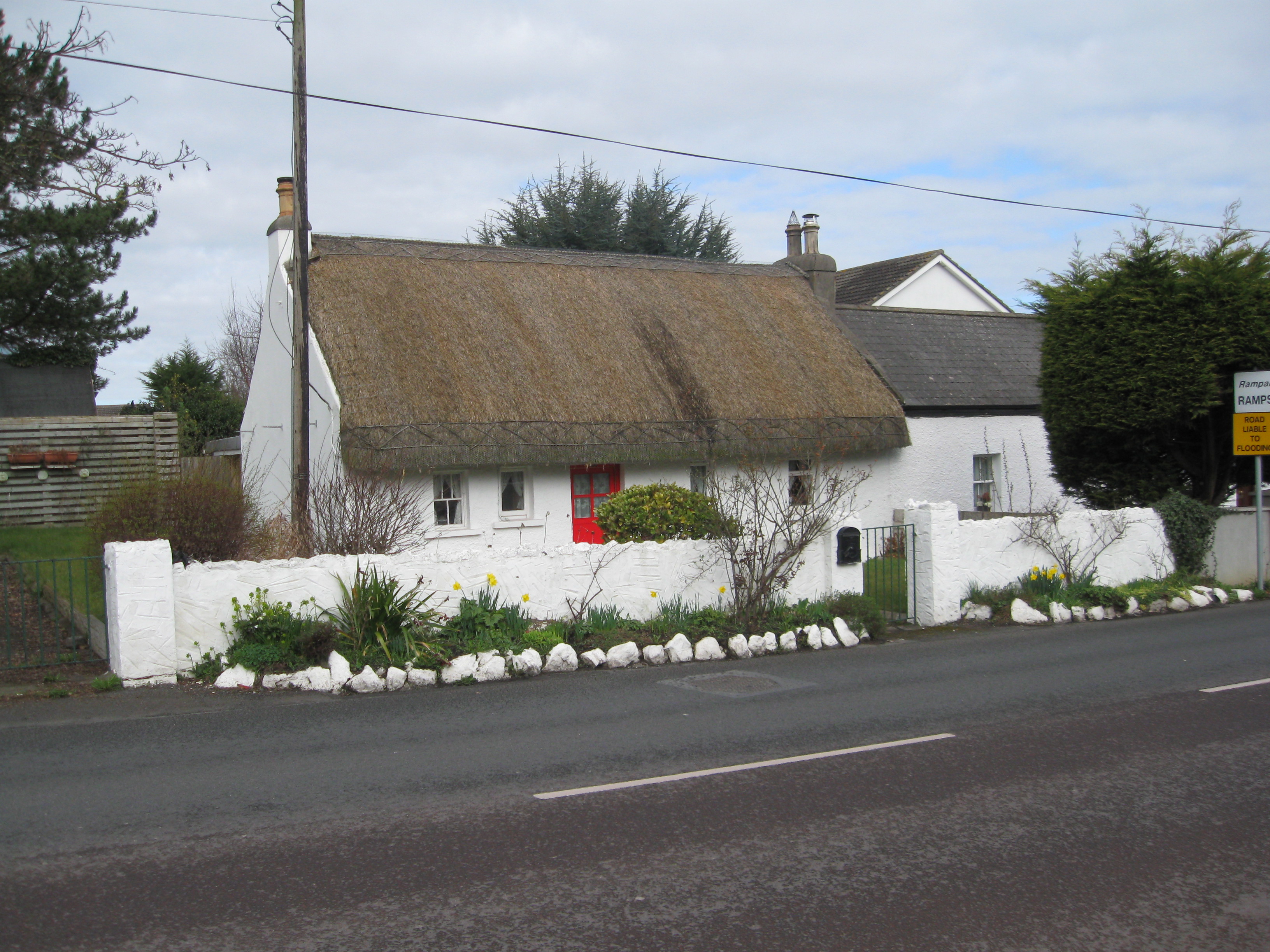
Pegram’s Cottage, Sea Road, Yellow Walls
This is the only remaining thatched cottage in Yellow Walls but at one time such houses were plentiful, both in Yellow Walls and in the wider Malahide area. The thatched cottage shown below stood on the Swords Road, about 200 metres from the turn for Estuary Road, until the late 1980s.
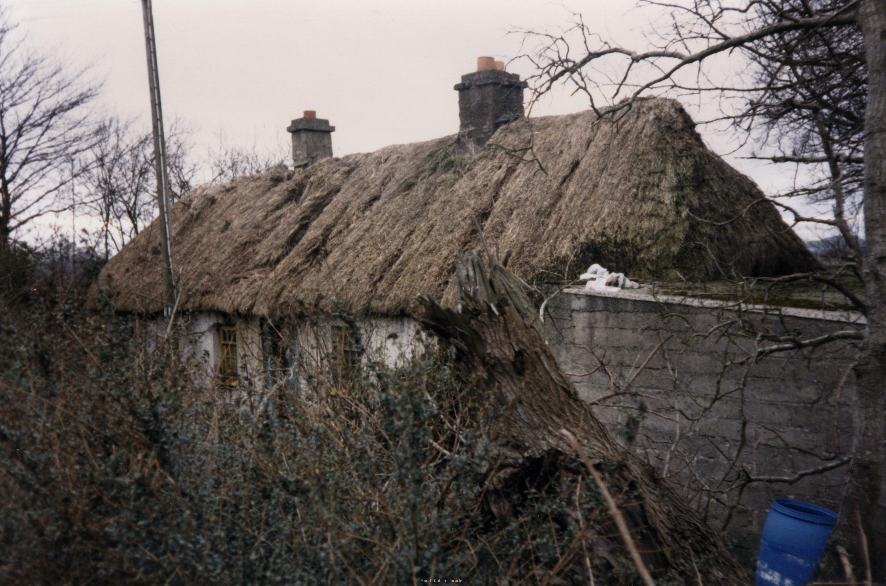
Ruined thatched cottage on Swords Road, Yellow Walls, c.1986. Source: South Dublin County Council Libraries.
At the crossroads itself, two cottages display plaques with the letters ‘TDM’ and dates of 1870 and 1879.
TDM stands for ‘Talbot de Malahide’. The Talbots, a Hiberno-Norman family, lived in Malahide Castle for hundreds of years, from the 11th century up until the mid-1970s. Lord Talbot built the cottages for workers on his estate, which today is one of a number of former estates of the landed aristocracy in the region under the care of Fingal County Council.

TDM – ‘Talbot De Malahide’
*A newspaper advertisement from 1781 offers for sale “the House and Lands of ‘Pea Field’, being but Half a Mile from Mallahide “.7
Sources
1. Little, George A. About Malahide. Dublin Historical Record, March-May 1948.
2. Europeana – the European digital library, museum and archive [online].
3. Census of Ireland 1851: part I, area, population, and number of houses, by townlands and electoral divisions: County and City of Dublin.
4. Archaeological Survey Database of the National Monuments Service [online].
5. Ordnance Survey Of Ireland 6″ Map: online. Reproduced under licence from Ordnance Survey of Ireland; Licence No. NE 0000414.
6. Ordnance Survey Of Ireland 25″ Map: online. Reproduced under licence from Ordnance Survey of Ireland; Licence No. NE 0000414.
7. Saunders Newsletter, 01 May, 1781.
8. Nolan, William. Tracing the Past: Sources for Local Studies in the Republic of Ireland. Blackrock Printers, 1982.

