V
arious sources including historic maps (1-4), local history records5 and oral history collections6 reveal past names for local roads, bridges, fields, landscape features, and areas in Yellow Walls that are no longer in everyday use.
The map below shows some of these names.
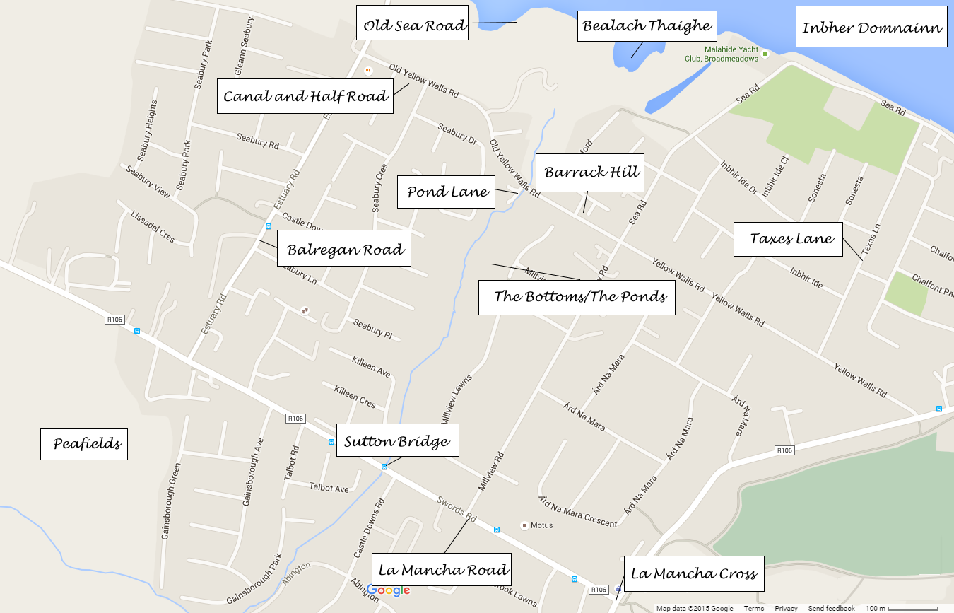
Sutton bridge, which crosses the Gaybrook stream where it enters the marshy area known as The Bottoms/The Ponds, is close to where the gate lodge of Gaybrook house once stood, to the left of the entrance to Castleheath and Abington. A family called Sutton lived in the gate lodge in the 1920s and 30s.
Old names of fields in Yellow Walls can be viewed at the Fingal Fieldnames Project website.7
Sources
1. Ordnance Survey Of Ireland 6″ Map: [online].
2. Ordnance Survey Of Ireland 25″ Map: [online].
3. Survey of the Town and Lands of Malahide. Clarges Greene & Son, 1851.
4. A Map of the County of Dublin : Divided in Barony’s, Reduced from an Actual Survey in four Sheets By John Rocque Topographer to his Majesty. Rocques, John, 1760-2.
5. O’Neill, Patrick. An Macalla, No. 10, April 08, 1962.
6. Schools’ Collection of the National Folklore Collection of Ireland. Available online at Dúchas.ie.
7. Fingal Fieldnames Project. [online].

