“At the end of this lane there is a big stream with a wooden plank across it, which is used for farmers crossing to milk…”1
The Irish Folklore Commission was set up in 1935 to collect and record material relating to the folklore and traditions of Ireland.
In 1937, it collaborated with the Department of Education and the Irish National Teachers’ Organisation, on an initiative to encourage Irish schoolchildren to collect and document their local folklore and history.
The children collected and recorded the material mainly from parents, grandparents and other older members of their communities.
Known as the Schools’ Collection of the National Folklore Collection of Ireland, the material is available via the Dúchas website.
Malahide is featured in the entries for Dublin county as recorded by local schoolchildren living in the area at the time. The entries are grouped under headings such as Local Roads, Local Place Names, Weather-Lore, Bird-Lore, Local Happenings, Games and Old Crafts.
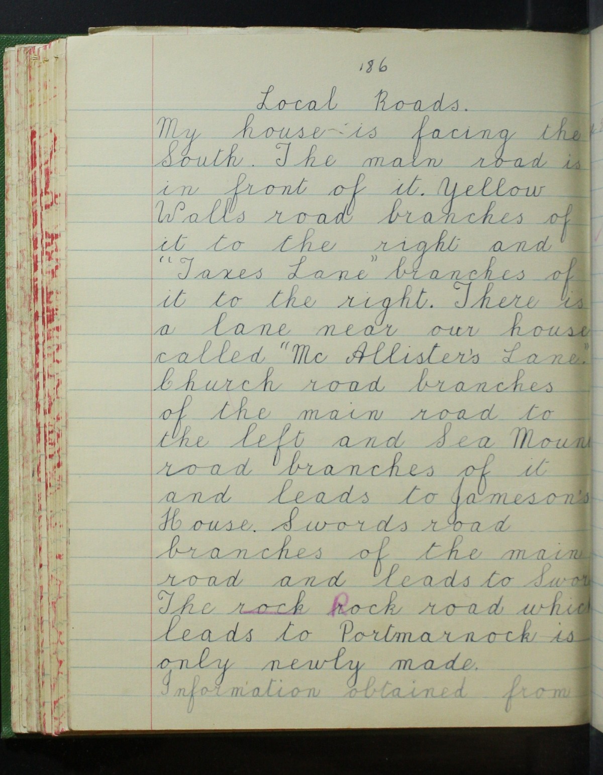
Sample entry for Malahide from the Schools’ Collection. Courtesy of Dúchas.ie.
In an entry on ‘Local Roads’ made by a schoolgirl named Laura Fitzgerald, the road to Swords at the Yellow Walls’ end is called “Balragan* road” – a reference to the one of the two areas that historically made up the modern townland of Yellow Walls, the other being Hamonstown.
She describes the end of Sea Road as having “big grass banks and little streams….and is called the Marsh”, a reference to Cave’s Marsh and the channels that were constructed to service the Saltworks.
The modern Old Yellow Walls road is called the “Strand Road to Swords” leading as it does to Estuary Road, which runs alongside the shoreline of the Broadmeadow estuary.
The Strand Road is described as having:
a little lane called Pond Lane which leads to many fields and streams. At the end of this lane there is a big stream with a wooden plank across it, which is used for farmers crossing to milk.
This is very likely a reference to a laneway that existed just off Barrack Bridge where it crosses the Gaybrook stream. Local historian Patrick O’Neill, also made reference to this lane in the 1960s, in relation to the old cotton mill, describing “the remains of storehouses and the laneway leading down to them.”
The “big stream” is Gaybrook stream while the “many fields” are those that would have existed on either side of the Gaybrook stream before the Millview, Killeen and Seabury estates were built.
The entry goes on to describe how:
…that stream begins at McMahon’s sand pit and runs on down till it comes to a little bridge called Sutton’s Bridge. It runs on down till it comes to a big rock and the water runs over it and that is called the water flow. It runs on till it comes to a bridge. It still runs on till it comes to the sea.
The “little bridge called Sutton’s Bridge” is where the modern-day bridge crosses the Gaybrook stream just at the entrance to the Killeen estate.
The description of the “big rock and the water runs over it and that is called the water flow” could be a reference to the remains of the millrace that serviced the old cotton mill. The last bridge referred to is Barrack Bridge, under which the Gaybrook stream flows as it passes through Cave’s Marsh and out into the Broadmeadow Estuary.
The origins of the name “Yellow Walls” are also given an interesting twist by schoolboy Christopher Mahon of Swords Road, who recounts how “it is said that Yellow Walls got its name from a public house that always had its walls painted yellow.”
*More commonly recorded as “Balregan.”
Sources
1. Schools’ Collection of the National Folklore Collection of Ireland. Available online at Dúchas.ie.

